Tap Into Interactive Flooding Map
| Published: 18th October 2011 22:46 |
A new interactive map is being drawn up to chart flooding hot-spots and Leicestershire County Council wants residents help.
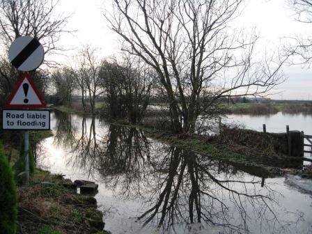
 Flooding on Back Lane, Castle DoningtonFrom this week, householders are urged to share what they know about flood locations, causes, frequency and damage. The data will help build up an in-depth picture of affected homes, extent of flooding, frequency and source and communities at risk.
Once complete, the map will help protect communities and reduce damage by shaping future prevention measures.
Peter Osborne, Leicestershire County Council's cabinet member for climate action, said:
"Flooding is one of the highest risks to local communities in Leicestershire so it's important we take steps to protect our residents and infrastructure.
"In Loughborough, we're already using state-of-the-art technology to improve our understanding of the risk and we are one of the first councils to establish a flood risk board involving partners.
"By being proactive and managing the risk, we can be better prepared to deal with a flood and help to alleviate the distress and expense flooding causes homeowners."
Residents can share information through an easy-to-use online map at: www.leics.gov.uk/flooding . Comments can also be sent to Daniel Rawle, Highways Asset Management Team, Leicestershire County Council, Glenfield, LE3 8RJ. Email danny.rawle@leics.gov.uk.
To prepare for flooding, the County Council has:
- Bought 10,000 new-style sandbags which self-inflate by absorbing flood water to protect homes and businesses.
- Created a network of over 100 specially-trained community wardens across Leicestershire who, in the event of a flood, would make sure that people receive warnings and know where to go for help. They also help communities to people prepare for floods, identify vulnerable people and report blocked drains and ditches.
- Invested £1million in highway drain improvements at locations including Blackfordby, Syston railway bridge, Market Harborough (working with Anglian Water), Narborough and Packington.
- Established a Flood Risk Management Board to ensure a co-ordinated approach with District Councils, Severn Trent and Anglian Water companies, the Environment Agency and also Leicester City and Rutland County Council.
Report this article as inappropriate
Comments
You need to log in before you can do that! It's only a quick registration process to join the AMA network and completely free.


 Help
Help


 Loading...
 Help
Help